Via Flickr:
Visit Our Website! II Facebook II Twitter II Tumblr II Capture Arkansas
For image licensing requests or photo related questions click here! or message me through Flickrmail!
___________________________________________
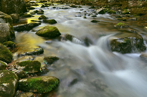
Sunlight shining through the bright green canopies high above paint parts of the stream with a beautiful greenish/yellow glow.
About Blanchard Springs:
Rainwater falling on the Ozarks has soaked into the ground for millions of years. As it moved through cracks in the limestone bedrock, it dissolved the stone and slowly widened the cracks to form Blanchard Springs Caverns.The water remained in the caverns until surface erosion carved valleys and allowed the water to escape. You are in such a valley now. As this valley cut deeper and deeper, lower sections of the cave were drained. New springs then developed below older dried-up springs. Blanchard Springs probably came out of the holes high on the bluff above us many years ago, when the streambed lay 20 to 30 feet above its present level.
This stream flows through bat sanctuaries on its way through Blanchard Springs Caverns. The water is enriched because of bat wastes and the decaying remains of those that died. Although this does not affect the appearance of the water, it does make it unsafe to drink.
Saturday, May 12, 2012
A Painted Stream
Wednesday, May 9, 2012
Valley Sunset
Via Flickr:
Visit Our Website! II Facebook II Twitter II Tumblr II Capture Arkansas
For image licensing requests or photo related questions click here! or message me through Flickrmail!
___________________________________________
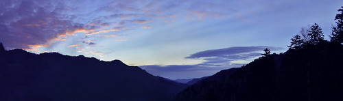
About Great Smoky Mountains National Park:
---------------------------------------------------------------------------
Great Smoky Mountains National Park is a United States National Park and UNESCO World Heritage Site that straddles the ridgeline of the Great Smoky Mountains, part of the Blue Ridge Mountains, which are a division of the larger Appalachian Mountain chain. The border between Tennessee and North Carolina runs northeast to southwest through the centerline of the park. It is the most visited national park in the United States. On its route from Maine to Georgia, the Appalachian Trail also passes through the center of the park. The park was chartered by the United States Congress in 1934 and officially dedicated by President Franklin Delano Roosevelt in 1940. It encompasses 814 square miles (2,110 km2), making it one of the largest protected areas in the eastern United States. The main park entrances are located along U.S. Highway 441 (Newfound Gap Road) at the towns of Gatlinburg, Tennessee, and Cherokee, North Carolina. It was the first national park whose land and other costs were paid for in part with federal funds; previous parks were funded wholly with state money or private funds.